Great Loop Blog # 100!!! Still So Much To Share.
- Chuck Hewett
- Aug 7, 2025
- 7 min read
I can't believe that this is the 100th time I've shared our adventures with you since we started the Loop last September 25. Allowing for the roughly 9 plus weeks that we've been away from the boat since then, I've averaged approximately 3.5 blogs per week or 14 per month. Greetings to all of you who still check in once in a while!
Tuesday, we awoke in Little Current with plans to cruise a quick 18 nautical miles to an anchorage at South Benjamin Island. "A good morning for a walk before we leave," said the Admiral and so, of course, we saddled up. It turned out to be a good walk, too. Given the role of government in Canada not to mention more than a little community pride in most of the small towns we've visited, we've typically found great parks, copious

flowers adorning village streets, and frequent historical interpretation plaques. Little Current offered all of these. We first stopped to read a couple of signs about the town's


logging past--a boom and bust story typical of most of the towns on the north shore of Georgian Bay and the North Channel. Interestingly, these mills were all built in the late 1800's (late 1880s early 1890s) when the lumber business was rapidly declining in Maine.
Soon after these signs, we found ourselves walking through a delightful, lakeside park. We passed friendly counsellors readying small sailboats while other adults coached children on the sailing plan for the day. Almost immediately afterwards, a Sandhill Crane croaked a lonely greeting. He was a harbinger of a good birding day. We continued our

walk and soon saw the ruins of one of the aforementioned sawmills on what is now called Picnic Island.

But back to the birds, having seen a Common Loon and a Downy Woodpecker on our way to the park and then the Sandhill Crane, we soon encountered a whole flock of Northern Flickers who appeared to be bulking up for their fall migration as they flitted along the ground foraging ants, other insects, and occasional seeds. Sad to say not one was willing to pose for me. ☹️. But our day was just getting started. As we walked through an edge area of woods, field, and lakeshore, we saw a Hairy Woodpecker, Black and White Warbler, American Crow, Yellow Warbler, Red-breasted Nuthatch, White-breasted Nuthatch, Song Sparrow, Common Grackle, Black-capped Chickadee, Red-eyed Vireo, and a Redstart--all confirmed on Merlin. The Admiral was in heaven! It made me think back to sophomore year in high school when my beloved biology teacher (beloved because he was also my ski coach), Pete Edwards, required each student to find and identify at least 50 birds during a four week period in the spring. There were a lot of early mornings for a color blind 15 year old to find those birds in the hours before the late bell at 7:55.
We finally got back to Katahdin and after a breakfast of oatmeal with walnuts, banana, and maple syrup, we readied our ship and got underway. Our trip once again reminded us of the immensity of the Canadian Shield. According to the Canadian Encyclopedia, the Canadian Shield ". . . refers to the exposed portion of the continental crust underlying the majority of North America. The crust . . extends from northern Mexico to Greenland and consists of hard rocks at least 1 billion years old. With the exception of the Canadian Shield, the rocks of the North America Craton are buried deep within the continent and covered by soil and other material. At 5 million square kilometers, the Shield makes up roughly 50 percent of Canada's land mass."
And where we are on Georgian Bay and the North Channel, if it's not underwater, it's the shield. Granite, granite everywhere.

Map of the Canadian Shield from the Canadian Encyclopedia
In any event, we arrived at South Benjamin Island only to find 14 other boats in the anchorage--no matter, we found a beautiful spot just for ourselves and dropped the hook.

After lunch, we headed off in the dinghy to explore a miniscule bit of the Canadian Shield. The Admiral led the way climbing up and up along the granite adjacent to our cove. Of course, life on earth is adept at grabbing hold and finding niches and the Shield
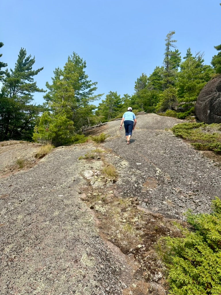
is no exception to that. Soon, we came to a beautiful glen that had grabbed a foothold amidst the granite, Reminding me of my friend, Neal, who is always saying to our friend Dick, "Dick, Take my picture," the Admiral said, "Cap, take my picture." And so, of course, I did.
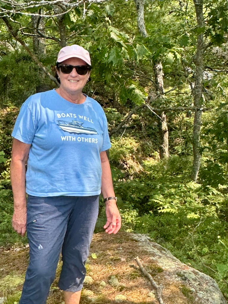
As we reached the high point of our walk, I heard another, "Take my picture." Looking around, I couldn't see anyone who had said it. And then, of course, I realized it was Kathadin, herself, calling to me on the breeze.
As we headed back to the dinghy, we ran into a couple and their two dogs who asked if we were the people with the Sabre. We said yes and they said "Thank you for supporting the economy of Maine." That led to an interesting discussion with Gerry and Bear from the vessel, Wandering Bear. Turns out that they live at Sugarloaf in Carrabasset Valley and Falmouth and are friends with our good friends, the late Roger Hewson, founder of Sabre Yachts, and his wife, Charlie--a loyal follower of this blog. All four of us said wonderful things about Roger and Charlie and then we went on our way.
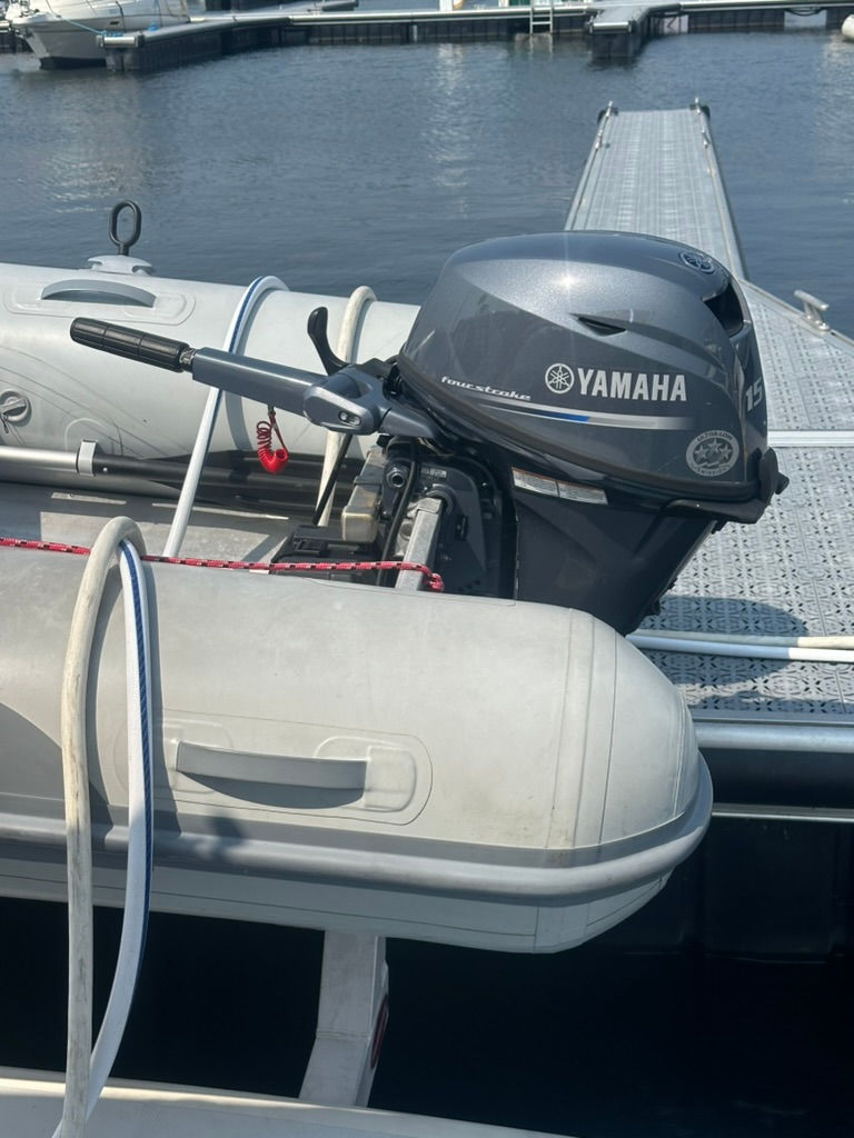
The plot thickens: As we headed back to our boat, the red oil light on our 15 hp Yamaha which has less than 25 hours on it came on and then the engine quit. I have to confess, on Mill Lake at minimum idle, we had hit a rock. I tested the engine afterwards. It didn't seem that there was any vibration and I watched carefully for any fluid leaking out of the lower unit. Nada. Shit, shit, shit. I must have missed something. We readied the oars, not as simple a task as you might imagine, and I rowed the half mile back to Katahdin (Did I mention my shoulders are stiff today?). Within 15 minutes of being back at Katahdin, the Admiral, wonderful organizer that she is, had lined up a service appointment for Wednesday (the very next day) at Blind River Boat Works and a slip for two nights at Blind River Marina. Change of plans, we are not going to the John Island anchorage after all.
Quelling my frustration with the outboard situation, we settled in to grill steak, steam potatoes, and make a large green salad on the boat and watched the evening unfold. We had been curious about the orange color of many of the rocks near South Benjamin which only became more orange as the sun moved lower in the sky. It turns out that a
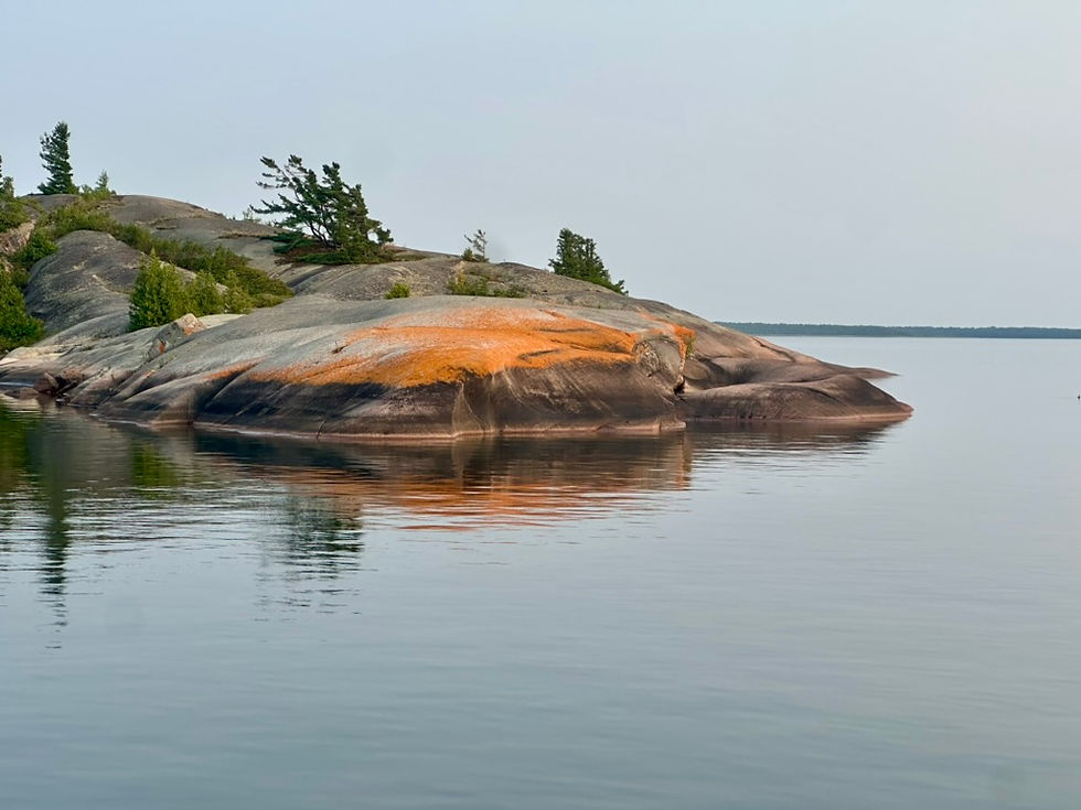
crustose lichen grows in areas of bird droppings (and sometimes other animal's scat) and shows off that amazing orange glow. While enjoying the colors on the rocks, we also watched the sun go down. I took a dozen pictures but thought you might like this one the best. Gotta love that forest fire smoke!

Wednesday morning, we arose bright and early, weighed anchor, and cruised offshore at 25 knots headed to Blind River Marina where we hoped the Blind River Boat Works folks would repair the dinghy's outboard. The weather freshened as we went and I started the SeaKeeper to reduce the boat's motion in a following sea of about 2 feet.

We arrived at Blind River at 10:00 and within 45 minutes, the outboard tech, Tyler, from Boat Works came down to look at the Yamaha. He asked a lot of questions, checked the oil, and couldn't see anything obviously wrong with the lower unit, so we lowered the dinghy into the water and started her up. Tyler must be scary to outboards--she ran perfectly. Hmm.
After messing with it for about 15 minutes and finding no issues, we agreed that I would go drive it around for a half hour and try to recreate the problem. Couldn't do it.
What happened to the outboard at South Benjamin? Here's my working theory. When we pulled the dinghy up to go for a walk, we may have inadvertently left the outboard tilted to the wrong side. That drains oil out of the reservoir into the cylinders which can cause low oil pressure. Whenever the oil pressure light comes on, the engine automatically restricts rpm's which probably caused the problem we felt at South Benjamin. Lesson learned and I doubt we'll tilt to the wrong side again!
Later, I walked up to see the Blind River Boat Works Owner, Brian, and pay him for Tyler's time. He wouldn't take any money and we had a good chat about warming winters and their impact on snowmobiling and winter tourism. Sound familiar?
A final note about Blind River. The marina is small, relatively new, and very protected in a man made harbor. It smells of federal financing. At the head of the dock is a modern building with an art gallery, small museum with rotating exhibits, and a small shop. The museum currently has a First Nation exhibit which the Canadians do a much better job with than we do. The major employer in Blind River is Cameco. It refines yellowcake to produce uranium trioxide, a product of the fuel cycle. You might expect a prosperous community. But, we rode our bikes into town Wednesday evening to have dinner at a local eatery and then walked the main street. Easily two out of every three store fronts are abandoned and the village looked very rundown. Pretty sad but typical of much that we've seen in many places around the Loop. On a happier note, they've got a great cross country ski club with its own hut and trails at what used to be a log boom camp just out of town. We went there on one of our bike rides.


Comments